

Canoeing on Lake Tyers
Long Point to Princess Highway Bridge
Another trip completed succesfully in January 2010 when the lake was extremely low.

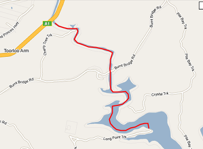
This was from Long Point up to the Toorloo Arm Bridge. It took about an hour each way and was very pleasant paddling with many insights into the wildlife of the lake evident. Some of the fish disturbed must have been magnificent, we just saw their mud plumes. The whole trip, including car travel, made it a total of three hours from LTB and back again.
Chris was canoe commander once more and even though some of the snags were close to the surface, as was the bottom of the lake at times, the journey was very pleasant. If you want to know the lake - take up canoeing :-) Again we acknowledge Google maps for this small inserted graphic. To view the whole area and get roads etc then consult Google Maps here. NB Google maps is incorrect as Burnt Bridge no longer exists, the north and south parts of the Burnt Bridge Road are not connected across the Toorloo Arm.