

How much water is in Lake Tyers?
How
deep,
or what is the lake level at? It is quite
difficult to say what the depth of a small-ish lake is when
there there is no "mean tide" level to work against. So what
ever level is given here is just general advice and needs to be
qualified by any local experience you can glean when visiting.
The level for a 'break out' through the sandbar on the current
rule at Nos2 Boat Ramp would be about +220cm (as an educated
guess). The 5 knot sign off the Nos2 Jetty had fallen over,
and is now replaced but may not be in the same position. Certainly
half way up the Bird Sign in front of the Tavern holds true, as
does the "Floating Bins" nearby.
Summary:
NB : Levels in the lake
continue to rise at least up to 3-5 days after rainfall
recorded.
The Winter of 2016 30 May 2016: Well it is nearly June, and the water is officially at 25cm on the Gauge at Number Two Ramp. Annual lowest point. Most of what rain we have had, and we have had consistent good falls during Autumn, has not been any really serious lake filling storms. A couple of blows from the South East looked promising, but it is probably draining out under the sand bar about as quick as it is coming in. only a few more months opportunity for a winter opening. The lake is considerably lower than this time last year, approximately 120cm (2015) compare to 25cm now.
The Summer of 2016
The lake has just about closed over at the bar and the level will stabilise now until the next Autumn rains. The lake has good coverage of water but this will drop a little more as seepage across the bar will find the mid-tide mark (ie where average seepage in equals seepage out). When the gunk inside the lake begins to seal the bar and reduce its porosity then rain water and occasional storm wash over will start to refill the lake (ie when the water is coming in faster than it can escape by seepage, or evaporate). December 4 2015
The 2015 Winter Opening
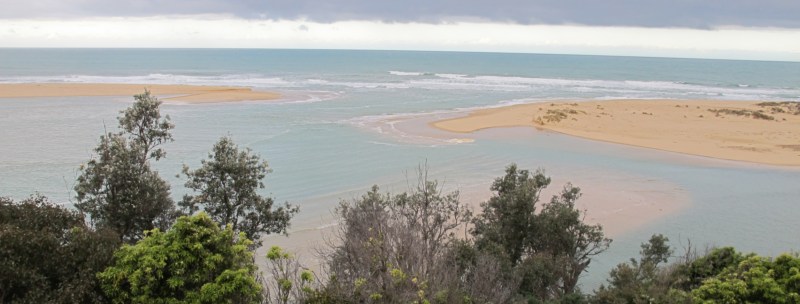 As
can be seen above the channel has widened towards the western
side. In previous years it has tended to move the mouth towards
the East. The SE storm over the last week or so has probably
caused this, and it has removed a couple of the larger dues that
were in that area. Sep 7 2015
 2015
August
the 8th, still full...
 2015
August the 9th. Looking out over the lake that is rushing out to
sea......
The openings have become almost a predictable annual event around July/August
 Number
2
Boat ramp around towards the sandbar...
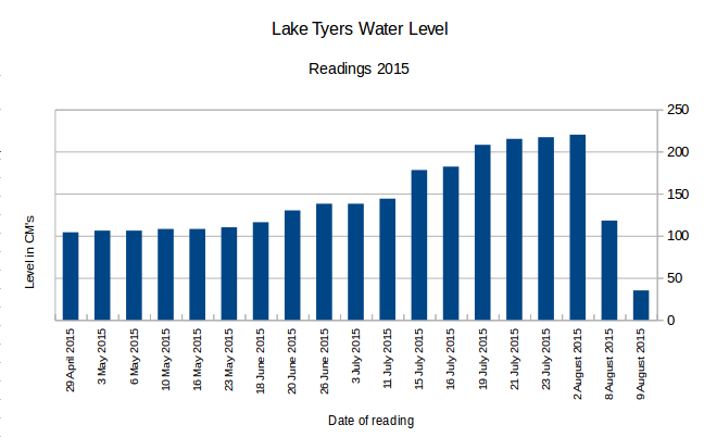
Above is a spreadsheet summary of the readings in 2015.
Alert:
Do
not
take your boat near to the sand bar when water is high as any
sudden collapse of
the sandbar could see it dragged out to sea very quickly. Please
heed warnings at the boat ramps. People walking on the sandbar
should also be very
cautious. The force of the water is extreme, and it
runs very fast.
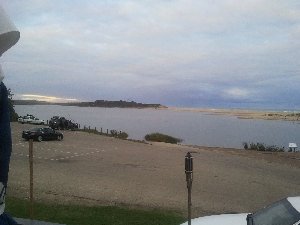 14
April 2014: Well
I
measured it at 80mm over the weekend and I was
amazed at how the lake had lifted. Opinions
were varied at the local watering hole, ie the
Tavern, some saying 5 feet!! others saying a
half a metre. On the conservative side I would
tend to say 500mm approx, but this is still a
very significant amount. All the sand bars
that were in front of the Tavern over Jan/Feb
have been covered. Apparently there is more to
come down, as the Nowa Nowa Mountain auto'
rain recording had120mm and Boggy Creek is
still pushing plenty of water down. What this
means to the Easter fishing remains to be
seen. The ground is soggy, so any more in the
next week or so will lift the level even
further. Stay tuned.
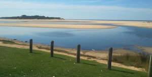 20
March 2014:
With Easter around the corner a report on the
level of the lake will not be out of order, and
I am sorry to report that it is at one of its
lowest times for this summer. We have had about
17mm of rain this last fortnight but it hardly
made a difference, though I am sure the plants
on the banks of the lake would have appreciated
it. So a lot of the sand flats around the Mud
Islands are exposed and water directly behind
the sandbar is divided into smaller channels.
The water quality is good with only isolated
reports of annoying weed. However lower water
usually means hotter water and less for the fish
to hide in :-) plus boating people beware, less
for boats!!


Summary:
| Date |
Level |
Change |
Rainfall
and
comments |
| 18 Jan 2026 |
50cm | +10cm | The rain has been sporadic, but certainly not drought conditions. However the lake did drop significantly while the heat waves on around the 9-15Jan '26. The islands shores as viewed from our balcony were obviously growing over this time. We have had some top up rains since, |
| 2 Jan 2026 |
40cm | Tidal | The lake has since opened and closed again. It was a natural opening and was positioned about halfway between where the worked opened it and the eastern end of the sandbar. For a shallow opening it lasted a surprising amount of time. We have had regular medium rain evens with a big one at the start of December, 25. |
| 22 July 2025 |
110cm | Tidal | The Lake was dug through (about 20 workers with shovels) and is now currently releasing water through the opening. It should empty to about 30-40cm on the gauge and then be tidal until it closes again. |
| 21 July 2025 |
110cm | -10cm | Big sign near the Toorloo Arm Recreation Reserve saying that Lake Tyers be opened tomorrow. Excitement is building.... |
| 1 July 2025 |
120cm | +2cm | A big East Coast low predicted. We will have to wait to see what it brings for us. Thanks to Geoff for feedback as well :-) |
| 17 June 2025 |
118cm | +23cm | Rains mainly coming diagonally across the state. Very little coming from across the west. Western part of Victoria is a bitter drought at the moment, we are doing quite well with small regular drops of rain. The islands in the lake are disappearing again so it will be hard for the plants that have re-emerged to go under water again. They are a tough lot but constant submersion must takes its toll. |
| 10 June 2025 |
95cm | +25cm |
We had a wild high come across and the trailing weather patter threw a lot of rain up from the ocean and gave a good soaking. The winds following along behind were icy cold. Fall of 25mm |
| 16 May 2025 |
70cm | +10cm | Winter rains are becoming more common with occasional good burst to lift the level of the lake. |
| 4 April 2025 |
60cm | -160cm | The lake has closed over slowly but sure over the last week or so and been topped up to at least ocean high tide level. We should see it leak out through the new bar over the next few months until reaches the mean tide level where any inflows are matched by outflows in either direction. At the moment the lake level would be higher than ocean low tide for example. It is good to see some recovery of the vegetation on the islands. They have been submerged for quite a while. |
| 18 February 2025 |
220cm+ | +24cm | The lake has opened "overnight" so most likely dug through. |
| 24 January 2025 |
196cm | +2cm | We have had a minor un-recorded bigger rise by maybe 3-6cm but overall it has gone up and down to an overall recorded rise of 2cm. Rain has been significant with one fall totaling 30mm but generally on a few falls less than 10mm at a time. |
| 25 November 2024 |
194cm | -16cm | The weather continues to confound the locals with not enough rain occurring at any one time to push Lake Tyers over and through the sandbar. It would probably require very high rainfall both locally and up around Buchan, at the headwaters of the catchment area to have enough momentum to make the break through. We have had quite a few heavy down pours of 20-40mm but nothing near the 100mm range that might do it. In the meanwhile low level seepage and evaporation make the bar literally that much higher, losing 16cm in about two months . |
| 7 September 2024 |
210cm | 0 | The lake remains at the same level for nearly two months. There has been resistance for an official because the top layers run off the lake first and leave the de-oxygenated water lower down. This will mean fish stocks will be crowded into an even smaller space and mass fish kills could result. This is a convincing argument, but what happens if it opens naturally? Sure the same thing will happen, only sometime later rather than earlier? |
| 20 July 2024 |
210cm | +29cm | Plenty of heavy rain, the lake is back up to 210cm but is unlikely to go any time soon unless much heavier lift the level and help it push through. The rains may also lower the berm. At the moment the berm is about 70-80cm above the level of the lake! |
| 10 June 2024 |
1.82 | +8cm | A great deal of rain, since 25May, 70mm approx, good falls but no opening as yet. |
| 4 June 2024 |
1.78 | +4cm | A bit of rain, but may continue.... |
| 25 May 2024 |
174cm | -2cm | Hardly any change over the last month. We have had a few bursts of rain, but none were real level changers. We await the winter rains and we will see what happens. |
| 21 April 2024 |
176cm | -4cm | Only sporadic rain, in an otherwise faultless Autumn. So cooling temperatures and less sun may have contributed to a lower evaporation rate, and the sand bar at the opening will be getting to the parts that will have been clogged with seepage for quite a while now. So while we have not had an opening, the scene is definitely set for one as soon as we have a good winter storm or two. |
| 4 April 2024 |
180cm | -10cm | Still no major rain event, and the likelihood of a Lake Tyers break out is diminishing by the day. We have had small trickles of rain since the new year and a minor storm or two, but no "lake-fillers". We will probably be looking for a big blow and rainfall event around June-July to fill'er up. In the meantime continue to enjoy the good weather and great water activities on the lake. Stay safe folks! |
| 16 March 2024 |
190cm | -10cm | Not much rain at all this month. About 30mm early and about 5-10 in last few days. Probably mainly evaporation, with a little seepage. However the lake is looking really healthy and vibrant. This will look after fish stocks of all kinds. |
| 11 February 2024 |
200cm | -10cm | The seepage, sun and wind must be taking its toll as the lake has dropped 10cm. This would appear to be reducing the likelihood of it opening. The fishing at the moment is great. The nos 2 boat ramp is chockers on this Sunday and there are Bream, Flathead and Garfish everywhere. Get your #12 hooks with a long shank, a non weighted float, throw bread crumbs out into the water for berley and cast out and drag your line above them. Remember only 2 hooks per line. |
| 1 February 2024 |
210cm | +8cm | Much speculation on the lake breaking out, or the sea breaking in. However the bar look solid and has not been blown thinner at the eastern end like it did last time. The profile looks pretty solid. The expanses of water look truly splendid and the fish are loving it. Everything is thriving. |
| 16 January 2024 |
202cm | +22cm | A storm cell went through Saturday morning, the 13th
and we got about 6mm in a half hour. There was some
cracking thunder and lightning. The place was jumping.
However the lake is stubbornly refusing to open. This
level is delightful for the tourists and local alike who
like motor about or paddle on the waters. The people who live at Nowa Nowa on the flats below the caravan park and behind the boat ramp will be understandably very sick of it by now. We are expecting a lot of rain tomorrow so this maybe the natural push it will need. The level is just touching the bottom of the bird sign and the bottom of the bins out the front of the Tavern. |
| 8 January 2024 |
180cm | 0cm | There has been steady falls all day with 18mm of rain recorded. Not stormy, but very overcast. The "Island Girl" boat was out fishing today coming in at 4:40pm in soaking rain. Those blokes are dedicated. Measurements were taken with the help of grandson Huw. The lake had dropped to 180cm due to seepage back through the bar and evaporation, this was not recorded officially but whatever has happened it is now officially 180cm. |
| 28 December 2023 |
180cm | +4cm | We have had 20mm of rain over the last fortnight and the lake is ion the rise. At the moment it is an ideal level for all sorts of water activities. However people are trying to interfere with the system by trying to dig it through, it maybe kids, but the lake is not a plaything for heroes. It is a natural system and deserves to be respected as such. It takes time and patience to truly appreciate the beauty of this place. |
| 12 December 2023 |
176cm | +4cm | The rises in the lake is about plateaued out by now and we can assume that the recent rain fall has produced by rainfall in the order of 150mm beginning to around 25Nov (54cm) to now, 12Dec 176-54= 122cm rise, 150mm/122cm is roughly 1.2, so produces a 1.2mm rain produces 1cm rise, so this is significantly less than previous calculations, even allowing for a wide margin of error. (see 21/10/2023) It could be easily explained though by the fact my rainfall gauge is in Lake Tyers Beach and is only one sampling point at the southern most past of the catchment area. The East Coast low looked quite consistent across the catchment area for a number of days, but this time it appears the runoff has been much more effective. |
| 6 December 2023 |
172cm | +6cm | A small rise so the influx of water maybe tapering off. We may get a max rise reading by the weekend. |
| 4 December 2023 |
166cm | +26cm | Another good rise, the lake is looking full with it
running over the pathway from the tavern to the beach
and up to the edge of the car park. So it needs another
54cm to 220cm, but that is not out of the question by
January. So look out!!! Too late for a Prawn run, though some may sneak in if opens. |
| 3 December 2023 |
140cm | +25cm | Looks like we will have an interesting next few days. If the bar is not consolidated properly we could have another low level breakout, that is, not requiring 200cm+ for a break. Otherwise we may have a good level of lake for the Xmas water activities. |
| 2 December 2023 |
115cm | +61cm | We have had another deluge with about 130mm with 6 days, and 110mm in the last 2 days. It will be fascinating to see how the level of the lakes goes up. We had a super East Coast Low system over the top of us and it just lingered and lingered, then dumped!!! Lake Bunga has opened. |
| 30 November 2023 |
58cm | +4cm | Plenty of rain falling. Much rain forecast and maybe more after that. |
| 21 October 2023 |
54cm | +2cm | Only a slight rise after all the runoff, plus an extra 1mm of rain. Back of envelope calculations indicate that it takes about 5mm of rain (right across the catchment area) to cause a 1cm rise in the lake. |
| 14 October 2023 |
52cm | +4cm | We have had about 20mm of rain about 2 days ago and we have seen another small rise in the lake level. This will confuse the effect of the 80mm in the previous downpour, but not greatly. |
| 6 October 2023 |
48cm | +10cm | Well it certainly happened, we had 85mm of rain in
about 36hours, and it really pelted down. It was a bit
stormy and high winds, about 35km peak, but the rain
fell continuously over that time. We had flash flooding
between here and Melbourne, but none around Lakes
Entrance, just minor flooding in Bairnsdale. What is notable the ground was dry, the rain came quickly and there was little beforehand so we can see what this rain has had on the level of the lake clearly. |
| 2 October 2023 |
38cm | -2cm | We are expecting as big down pour of rain according to the BOM. We have fires out of control at Loch Sport and Briagalong. |
| 6
September 2023 |
40cm | +15cm | We have seen a gradual rise over winter, but nothing spectacular. We certainly not had the wet winter of 2022. We will be lucky if we get an even slightly wet spring. Anyway we had 17mm last two nights and 28mm within the fortnight. A welcome top up. |
| 7 May 2023 |
25cm | +5cm | We have had several rain evens with falls in the 40 - 60,mm in a fortnight and the lake has appeared to to have risen a little, however not as much as might have been expected. There may be still considerable leakage through the bar. |
| 11 April 2023 |
20cm (est'd) |
-25cm | We have had a pretty dry start to the year, similar to 2019, about 100mm from Jan to March. We had about 2-3 times that in 2020,2021,2022. Recently though we have had an extra 100mm in early April. This will put us so , halfway between the drought years, and recent heavy rainfall years. The lake is low but the level has not gone negative on the measuring stick at Nos2 Boat Ramp. |
| 20 January 2023 |
45cm | -145cm | The lake has closed again. However the opening has moved about 70 meters eastward from where it opened last mid November. This has cut quite a large chunk out of the eastern dune and created quite a channel system on that side of the lake. There appears to be some water though still coming in from wave action over that part of the bar. It was enough to wash a part of a whale carcass about 20m into the lake. The large segment of backbone has been popular viewing with locals and tourists alike. |
| 14 November 2022 |
190cm | +20cm | Well the lake did open and quite a good one again for a low breakout level of 1.9m. The entrance has been created as expected at the far eastern end and very close to the dunes at that end. |
| 4 November 2022 |
170cm | +8cm | The tail end of the strong spring rainfall. We are
expecting more over the coming weeks, the ocean driven
weather patterns are all around the continent. We do not
seem to be immune from what is happening in the Indian
Ocean and what is going on in the Pacific off the shores
of Queensland and the Islands. The sand bar between the
lake and the ocean is very thin and low, suggesting with
a storm and an ebbing tide the lake could open and then
become tidal again. The water level is still well below the normal 2.2m we used to predict was necessary for an opening. However the last opening at about 1.2-1.4m put pay to that as an universal truth. So with the right weather conditions we could easily see an opening soon. |
| 1 November 2022 |
162cm | +96cm | Quite a lot of rain has fallen and much has ended up in the lake. The view from the tavern is a single sheet of water now with all the smaller sand bar/dunes covered. Not much evidence of storms here but plenty of flooding in other parts of riverine Victoria. |
| 22 October 2022 |
76cm | +6cm | We have had a wet winter with weekly rain for most of the time. The catchment area is quite waterlogged and whatever falls turns into lake level rises. This has been reflected across the state with flooding on the Marybinong and up north at Rochester, Echuca and Shepparton, just to name a few towns effected. |
| 8 October 2022 |
70cm | +40cm | Consistent rains have gradually lifted the lake level. 51mm of rain in the last fortnight, and due to very soggy catchment, the lake level is now at 70cm at the Number Two Jetty. A rise of around 40cm since the opening closed over. It sure has changed the appearance of the lake in front of the Tavern. |
| 5 April 2022 |
0.30cm | -66cm (Tidal) |
So it is definitely open and now tidal. It just reinforces the advice given to people not to go out on the bar when it might open. This was a surprise opening as it opened somewhere around 120cm to 130cm over night. This is about a metre below what it took to open in the previous two openings (and most of the openings before that). It does indicate that the "it takes a 2.2m reading to open" Rule is not cast in stone and can be quite variable. It will be interesting to speculate what will happen to the Prawns. Many will escape and if they do they will help make sure we get more Prawns next year, so go go little Prawns!!! |
| 4 April 2022 | 1.06cm | -14cm | And yes it has opened. Not as deep as the previous opening, so it may not last very long, but still setting a record for many people. |
| 3 April 2022 | 120cm | +42cm | A huge downpour on northern NSW has come down the coast and is dumping on us at the moment. The lake has risen 42cm in the last fortnight, most of it in the last 3-4 days. Much heavier rain is predicted tonight and rivers and towns along the East Gippsland coast have been told to prepare for flooding. This may not be as bad up north, but could easily create a lot of havoc. Two years ago at this time of year we being burnt out by bushfires. Whoever said the hallmark of climate change was going to be more of the extremes weather is correct. We may be looking at a 3rd opening within a year? |
| 17 Mar 2022 | 78cm | +28cm | The lake has closed over and we have had significant rains (60mm+) in the last month and this has caused a reasonable rise in the lake. Part of the Mud Island is now covered again by water. The lake closed over around the 10th of January and apart from some rough weather causing a lot of wash over the bar, it has been pretty static. |
| 23 Dec 2021 | 50cm | +28cm (Tidal) |
The level has risen due to the tide, and maybe a bit of push down from recent rains. Most likely just and indication of a reasonable high tide as the entrance is still open and maybe a meter or so deep at high tide. This has been a long opening and should be giving a real flush out to the lake system. |
| 26 Nov 2021 | 22cm | -13cm (Tidal) |
The lake is still tidal, though the opening is quite shallow at the moment. However we have had very generous rains recently 212mm in about 2 months. This will keep a steady flow through the lake over the next month or so. Prevailing winds and storms from the ocean side will largely dictate whether the lake is soon closed over or not. The salty water is heavier than the freshwater and will run up the lake under the freshwater, displacing it to run out over the top. Unless there is significant turbulence these layers can remain quite distinct. Over time the wind will mix it all up, but the moment it is probably carrying Prawn larvae up and spreading over the bottom of the lake. |
| 23 Sep 2021 | 35cm | +10cm (Tidal) |
The lake has been tidal now for several weeks and the prospect of Prawns for Easter are looking better and better. The ramp at Nos2 Jetty had to be dug out with an excavator last week because of the build up of a sand bar in it meant boats could not exist the ramp. The excavator has dumped the sand below the cleaning table and it looks like a reclaimed beach at the moment. |
| 11 Sep 2021 | 25cm | -185cm | The lake is definitely tidal now, with a strong onshore breeze, the white caps were almost reaching the Number 2 Jetty. The colour of the water has definitely changed to blue rather than the tannin lake colour. Maybe we will have prawns in the lake to be caught by Easter? |
| 9 Sep 2021 | 210cm | +12cm | The Lake has opened again. It was during the day as people watched and filmed. So a natural opening. A strong northerly breeze pushing down the lake. Much more vigorous than last time, but about 10-15cm lower as the sand bar had not had much time to build up. |
| 7 Sep 2021 | 198cm | +59cm | This has been a huge jump. Much bigger than expected. Boggy Creek must be roaring down. The last 55mm rainfall burst measured here at LTB must have been heavier and longer up around Buchan and Nowa Nowa. It would seem we are close to another break through. Stay tuned! |
| 5 Sep 2021 | 139cm | +43cm | Another handy drop or too, to the tune of 43cm over the weekend. Some really heavy falls apparently. The floating jetties are almost level to their base hinges at the moment. This is a promising start to Spring, lets hope it keeps it up. It certainly puts us close to the possibility of a second opening. It was about this level previously last Feb, 2021. The only difference is the rain is now falling on wet ground and giving maximum run off. |
| 1 Sep 2021 | 96cm | +13cm | There must have been considerable rain in the catchment area with the last 60mm downpour has the lake has continued to rise and come up 13cm from a couple of days ago. This is good news for the area in general. On our walk in the Red Bluff Bush today the energy of the regrowth has been really kicked along. |
| 29 Aug 2021 | 0.83cm | +45cm | With recent rains the lake has risen significantly. The 60mm that fell at Lake Tyers Beach would indicate that significant falls occurred in the catchment and that has been reflected in the lake level. The surrounding bush is very dry and it would take a few falls like this to get us within range of an opening. However at this time of the year, rainfall such as this is very welcome. We got the rainfall from an East Coast Low formation that formed out to see off NSW and drifted down towards us and finally over the Tasman towards New Zealand. The strong clockwise winds generated big southerlies coming in off a warm sea, laden with humidity, and dropping rain over the cold coast line. It hung around for 4-5 days and worked its magic! |
| 20 July 2021 | 38cm | +13cm | The lake opening has been closed
over for over a fortnight now. There is no hope of the
Prawns returning this season with such a short window
and probably too early for the east coast currents to be
bringing the larvae down. The deep cut made at the eastern end of the sandbar was very effective at lowering the lake quickly, but after a long finger of sand deposited back into the lake, the opening closed over quickly afterwards. Having seen the beach previously change massively overnight, where a gentle slope to the water has been changed to a steep edge, it is not surprising that a small lake opening could be closed over so quickly. The most likely reason is that the follow up rains to keep Boggy Creek thundering down and pushing more fresh water out the opening has allowed it to fill up with sand quickly. However this would not explain why it has stayed open and tidal for 3-4 months previously. |
| 28 June 2021 | 25cm | -204cm | The lake is now tidal and will hover around the indicated value as the tide comes and goes. The opening has already formed a large spit into the lake on the west side of the opening and continues to gouge a cliff on the eastern side. This activity will see the lake opening move along the beach over the next few months. |
| 14 June 2021 | 229cm | +29cm | The last 60mm or rain has pushed the lake through and having peaked is now falling rapidly. The lake seems to have opened naturally at the eastern end where the sand bar was thinnest. Various antics were observed of people on the bar, some trying to dig the thicker part through with a kayak paddle?!? Anyway most of the lake will have emptied in a day or two and then we will have to see how long it stays tidal for. Hopefully it will be long enough for restocking some fish species that do not breed in the lake (eg Snapper, Leather Jackets, Salmon etc) and provide a feast for the local sea fish, no doubt, gathering around the outflow. It has been a great local relief for the Lake to open again since this time of year in 2016. Five years have elapsed. |
| 5 June 2021 | 200cm | +10cm | The level of the lake has risen consistently with recent rains, and with the storms in the Latrobe Valley wreaking havoc, we have been lucky to get away with a bit of strong winds and around 44mm of rain. Reports of Boggy Creek rushing down would indicate these falls have also been in the catchment area, so we can expect the lake to rise some more over the next few days. With only 20cm to get to the critical 220cm level, any sort of swell or wind conditions could be enough to start the opening. People who are determined to walk on the sandbar at this stage, in these conditions, need to be considering the dangers. A strong east coast low would definitely push the lake to open. |
| 20 May 2021 | 190 cm | +73 cm | We have had significant rain and the level of the lake
has risen dramatically. This has stirred the community
to speculate on when the lake is about to open. It is
certainly in a better place than the last 5 years, when
it last opened in 2016. Here is a photo of the level
around when it opened last time.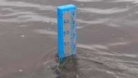 It had to reach at least 2.1m before breaking out. So the lake is very close but not quite enough. 2.2m would see it out. If we get heavy rain up around Nowa Nowa to Buchan and Boggy Creek flows like it did in 2012 then we may see it open very soon. We may see these scenes over again, and again. Some people just love their fishing!!! Otherwise tootle over to a history of breakouts since the mid2000s. |
| 21 Mar 2021 | 127cm | -11cm | Over the last fortnight rainfalls of around 35mm in total at LTB have failed to lift the lake above its current level, or counter the drop. Either there has been little run-off due to very dry forest conditions or the falls have been uneven locally, with much less rain falling up around the town of Buchan. Unless there are significant falls in the northern hills, the local catchment at the southern end of the lake, where we are, is very small and will have little effect. |
| 15 Feb 2021 | 138cm | 0cm | In spite of recent heavy falls of rain the lake level has remained fairly constant. If was going to show an accumulation it would have registered by now. Over winter this sort of fall would have caused maybe 5-10cm of rise. This could be an indication of quickly the environment dries out over summer. |
| 3 Feb 2021 | 138cm | +2cm | OveXXXXXXXXXr the last 10 days we have had in the region of 49mm of rain. It will probably not be apparent what the total effect of this rain has on the level of the lake for a number of days. The rain has fallen in three main bursts so the last two bursts may have resulted in reasonable run-off after the first burst had wet up the district. As usual we also need to factor in the rain at LTB is not in the main catchment area, and it is the total rainfall in the Buchan to Now Nowa area that will be critical. The Nowa Nowa BOM service indicates this time, similar falls of around 50mm as well. |
| 30 Jan 2021 | 136cm | -12cm | We have had about 31mm of rain in the last 4 days. There maybe enough to lift the level of the lake. However talking to gardeners, the they report the top level of soil (20-30cm deep) is dry as dust and will take any amount of water. On the other hand they report it is so dry it will not wet up easily. If the level is taken again next week we might see whether it has been absorbed into the soil or runs off. The proliferation of private dams, tanks and other pumping devices are preventing many other rivers from getting their full run off, we will have to see whether our lake lifts or not. |
| 5 Dec 2020 | 148cm | N/A | The lake has been hovering around this level for a couple of months now. Small top ups (falls less than 15mm) do not seem to make much difference. |
| 23 Oct 2020 | 148cm | N/A | Steady as she goes at the moment. What has fallen in the last month (~40mm) has drained away back to the sea. One person reported that there was a plume of tannin laden water leaving the bar and heading into the ocean. The lake surface temperature is around 16-18C at the moment and no real stinking hot days so not much due to evaporation. We have had quite a few hot dry northerlies and the ground would be drying out. This would mean a huge dump of rain would be required to first wet up, and second to run off into the lake, and maybe causing it to open. Certainly not impossible but gets less likely as we get closer to December. 70cm lake level rise would be required. |
| 27 Sep 2020 | 148cm | -2cm | We have had some good fall but not much above 5 to 12mm at a time and the lake is going slightly lower at the moment. This could be due to evaporation or leakage through the sandbar, either way we will need a very good dump and quick before the summer drought resumes. The longer the rain takes to to arrive the drier the ground will become and the longer it will take for runoff to be significant. The result of this will be drier forests around us and more likelyhood of catastrophic bushfires. |
| 30 Aug 2020 | 150cm | +4cm | Boggy Creek continues to raise the level. We have had some rain every few days since the last major downpour, but nothing to really change the level of the lake much. If you are into boating and enjoy fishing now, is the time to give it a crack as the waterway is easily navigable and in really good condition. |
| 20 Aug 2020 | 146cm | +53cm | We have had about 35mm of rain in the last week and a half, and this has pushed the level up by 53cm, quite a bit of movement. Most of the islands are under water and the the opening on another dump like the last one and the lake will be soon to open. Thanks to Guss and Frank who have kept me updated while I was away with the Lake Level. Thanks to Johnno on the ABC for a chance to talk about the lake levels and the possibility of an opening last Tuesday morning (9am). At the moment it is looking quite a picture and it will be a shame if it opens too soon, as we like to see it with at least a fair bit of water in it. |
| 14 Aug 2020 | 93cm | +10cm | Not much rain this week, so must be Boggy Creek runoff slowly pushing it up. I wish I had an online gauge up at Buchan. Anyway we have had a about a Metre total rise over the last 4-5weeks. Not bad going. |
| 6 Aug 2020 | 83cm | +8cm | The catchment area must be saturated
as we are still getting a rise in level without any
rain for the last four days. this augers well for this
weekend when we are expecting another downpour in East
Gippsland. |
| 2 Aug 2020 | 75cm | +17cm | We have a lot of runoff and with a fall of 26mm over this weekend, it has pushed the level up significantly. Maybe there was more again up around Buchan.(Thanks Guss for taking this reading). |
| 29 Jul 2020 | 58cm | +38cm | After a beautiful East Coast Low we had a fall of 38mm over about 5 days. No storms just rain. It is very encouraging to see the East Coast Lows forming again. They are vital for this area of the world to avoid drought. It is approximately four years since the lake last opened, and it has not been this high since then. However there is a long way to go. The last time it opened, Buchan recorded about 150mm rainfall in one hit. So anything is possible. |
| 19 Jul 2020 | 20cm | +37cm | We have just recently had some weekly rain of 5-10mm,
but last week we had a really good East Coast Low in
action and managed to score 48mm of rain within 3-4
days. This was enough to cover the huge sand bars
exposed by the previous low levels. However the lake
will need to rise about another 200cm before it is
likely to open. Given the lowest part rise the quickest
with the least amount of rainfall we are long way of
opening the lake. The last time it was about this level was in the Summer of 2018. |
| 12 Jan 2020 | -17cm | -10cm | Well we are in the middle of the fire season in East
Gippsland. The ferocity and total annihilation of
environments from here to the mountain tops of Mt Hotham
to the NSW border and beyond is shocking. The drought is
the Climate Change's Grim Reaper, and things have burnt
like they have never burnt before. Highly experienced,
and professionally conservative experts have been
shocked with the extent and degree of the damage. And we
are barely past midway in January! We have had several short bursts of rain, but nothing to make an impression on the level of the lake. The lake looks even lower as the high sand has been washed into the lower parts and even more looks exposed. So by me it is almost as low as it was in March last year, so we are nearly 2 months ahead. |
| 8 Sep 2019 | +7cm | +15cm | It is a good thing we measure things, if I was asked to judge I would have said it was still very low, but this is the 3rd positive increment reading in a row. We have not had heavy falls here, rarely over 10mm a fortnight, but up in the catchment area, plus some run over surf, is probably what has lifted it. Anyway, good news, we are back in the black!! |
| 14 May 2019 | -8cm | +6cm | 78mm over 10 days in the last fortnight has lifted the lake by 8cm. Not much but we have to take what we can get these days. Hopefully the soil will moisten up and runoff will increase with further rain. We could with more significant falls to fresh3en up the lake. We shall see, the trickle down effect definitely not working here. |
| 19 April 2019 | -14cm | +4cm | Two recent downpours of 43cm last week (36cm+follow up of 7cm) has resulted in a lift in the level of the lake by 4cm. However visually the lake appears even lower than the last report with the islands nearly all connecting up and only small channels running between them. The bleached sands are quite dramatic and are probably adding to the impact and wrong impression that is has got even lower when in fact it has risen a bit. However that current level is about 2.35m below the opening point! So we need a lot of rain to flush the sandbar and refresh the non-lake breeding stock. Reports are though, that the fish are biting well all the same, so things are not all that bad. |
| 17 Mar 2019 | -18cm | -6cm | The last month has seen very little rain, and for the
last three weeks we have definitely had only a couple of
light showers that barely settled the dust. The sandbars
around the islands in the lower lake and behind the bar
are growing by the day and bleaching white. The islands
are nearly all connected so technically no longer
islands!!! The depth at Number Two ramp is becoming a problem. The launch depth is ok, but there is a mini bar behind it thrown up by people using their motors to get their boats onto their trailers. So if you have a bigger boat you may like to check it out and plan ahead. |
| 10 Feb 2019 | -6cm | -12cm | We have have had consistent small amounts of summer rain. Each time barely enough to settle the dust, but welcome all the same. There is much more of the sandbars exposed in the lake and the algae bloom (the good green stuff, not the blue green) has passed. The lake appears in good condition as the low rainfall has ensured there has been little runoff from the surrounding bush, though this must be taking its toll on how much 'feed' comes into the lake as well. Our rainfall pattern appears to have shifted from pretty wet winters, that filled the lake, and dry summers, to mildly wet winters and summers. This makes a fill and break out of the lake very unlikely. |
| 29 May 2018 | 6-7cm | None | The small amount of rain recently has not raised the level of the lake at all. It has flattened out the ever increasing sandbar out in front of the Tavern. There are points around the inside, the lake side of the sandbar that weep water back into the lake. I am guessing this would be coming from the ocean through the sandbar. After 2 years without a breakout the sand would be most likely clogged and not be very porous, but given how low the lakes is some must be making it through. |
| 8 May 2018 | 6-7cm | -3cm | We have had much less rain than this time last year
and have had to improvise to estimate the depth of the
lake. Using a spirit level, the 50cm line was marked in
several jumps out to where the water is now and a marked
Aluminium strip pushed into the sand to level with the
50cm mark.This is looking like a significant drought on
the way, and filling the lake this year seems less and
less likely.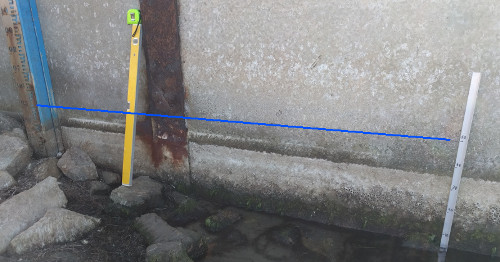 |
| 1 Apr 2018 | 10cm (est'd) |
-28cm | The rainfall has been very low and very erratic. The lake level has been falling and large sand bars have been exposed behind the main bar. These have been accentuated by wind blown sand as well. The drop is most likely because of low flows from the catchment area and high evaporation. However the lack of sea water coming through the bar may indicate that the bar has sealed and further rain may cause the level to rise and not leak away so easily. The level on the rule is covered by rocks and sand so the 10cm is an estimate. |
| 5 Dec 2017 | 38cm | +4cm | We had a big downpour by recent records. 65-70mm recorded over a number of days. However it has not shifted the level of the lake much at all. It may have been the very dry undergrowth, or lack of really heavy rains in the catchment area, whatever happened, the rain and some run in from the surf (we had spring tides and onshore swell yesterday) did not make much difference. Hopefully it will have freshened up a few people's tanks, dams and water storage for the long haul over the summer. |
| 13 Nov 2017 | 34cm | +2cm | We have had 122mm since the 22/8/17 (below) and yet the lake has not risen significantly. The rate of incoming water versus losses by seepage (through the bar?) and evaporation have cancelled it out. More big Spring type rains are possible, but the earth is so dry at the moment it would take a really sever storm or a fortnight of heavy rain to get the run-off required. |
| 22 Aug 2017 | 32cm | +2cm | We have had about 30 mm in the last fortnight, but this has barely wet the topsoil and litter, so a long way to go before any significant rise in the lake. |
| 8 Aug 2017 | 30cm | 0cm | Too little rain and when it does come it maybe too
late to force an opening this year. Things are looking
pessimistic since Easter. Last year 1June to Aug8 2016,
we got 120mm, this year we have got 25mm during same
time span! About a fifth! This spells out a serious
warning, drought??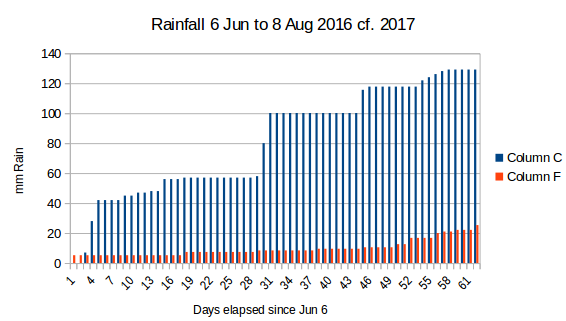 |
| 4 Jun 2017 | 20-30cm | +10cm | We have had very little rain this year. Most of it was scattered with only downpour that was bigger than 20mm. Consequently ground is very dry and any rain does not lead to significant runoff that could lift the lake level. We will need some big storms soon if the sandbar is to be broken this year. |
| 13 Feb 2017 | 10-20cm | -10cm | The lake has entered the phase where it is completely cut off by the sandbar and the summer heat is evaporating the lake and rainfall is very low for this area. This will continue until the summer breaks and winter sets in. |
| 25 Jan 2017 | 20-40cm | 0cm | The lake has closed for this 16/17 summer season as we see increasing rainfall it tend to rise depending how much falls in short amount of time. |
| 26 Oct 2016 | 20-40cm | Tidal | A massive storm has widened the mouth and leveled off half of the dunes on the west side of the opening. The sea surge was so powerful it was running up the track at Red Bluff, and at the sandbar appeared to have made two openings to the lake. This will almost certainly make the lake stay open until around Christmas time now. |
| 20 Oct 2016 | 20-40cm | Tidal | The recent rain, and probably the storms as well, has widened the entrance and will keep the lake tidal for another month or so at least. The water quality is excellent and quite a few whales have been spotted from Beacons Lookout on their way back to the northern waters. |
| 23 Sep 2016 |
20-40 cm |
varies Tidal |
Still tidal but with the
opening much narrower and could close over fairly soon.
Recent rains of 100mm (approx since Jul21) have keep the
lake healthy and flushing OK. Should be good for summer
season. |
| 21 Jul 2016 |
20-40 cm |
Varies, Tidal |
At the moment the tides
are washing in and out of the lake and it is rising and
falling about 20cm. The sand bars in front of the Tavern
are sometimes covered and other times exposed.Clear
water is reported as high as The Island. |
| 8 Jul 2016 |
30cm |
-190cm |
Lake opened and so we
begin the cycle again, and it means the lake will be
tidal again for another few months, replenishing fish
stock and flushing water. |
| 7 Jul 2016 |
220cm |
+136cm! |
Rainfall at Lake Tyers
Beach was 40mm over this period, but vast quantities
fell north of here with 150mm around the catchment area,
eg Buchan where the caves were closed for a day due to
rivers running past cave entrances. Lake opened
naturally today about 8am. Boggy Creek must have been
thundering down. |
| 1 Jul 2016 |
84cm |
+8cm |
Maybe more rain fell in
the catchment, as non fell down here. So probably Boggy
Creek inflow, with possibly a stormy bit washed in over
the bar. |
| 22 Jun 2016 |
76cm |
+11cm |
Run off from surrounds
and from Boggy Creek, no rainfall in last 24hrs |
| 21Jun 2016 |
65cm |
+33cm |
About 60mm of rain
arrived in stormy conditions form the SW as part of a
East Coast Low and a prevailing westerly cold fronts.
Last sandbar in front of Tavern now just covered. |
| 11 Jun 2016 |
32cm |
+7cm |
About 50mm of rain up
till today with heavy showers expected. |
| 30 May 2016 |
25cm |
Annual Low |
There may have been small
fluctuations, but the lake has been at its lowest point
now since the opening last August. We await more
substantial winter rains! |
| 9 Aug 2015 |
Opened |
Dropping! |
Sometime over night the
sandbar has been breached and there is massive channel
through the bar and the lake is dropping fast. |
| XXXXXXXXX |
The Winter of 2016 30 May 2016: Well it is nearly June, and the water is officially at 25cm on the Gauge at Number Two Ramp. Annual lowest point. Most of what rain we have had, and we have had consistent good falls during Autumn, has not been any really serious lake filling storms. A couple of blows from the South East looked promising, but it is probably draining out under the sand bar about as quick as it is coming in. only a few more months opportunity for a winter opening. The lake is considerably lower than this time last year, approximately 120cm (2015) compare to 25cm now.
The Summer of 2016
The lake has just about closed over at the bar and the level will stabilise now until the next Autumn rains. The lake has good coverage of water but this will drop a little more as seepage across the bar will find the mid-tide mark (ie where average seepage in equals seepage out). When the gunk inside the lake begins to seal the bar and reduce its porosity then rain water and occasional storm wash over will start to refill the lake (ie when the water is coming in faster than it can escape by seepage, or evaporate). December 4 2015
The 2015 Winter Opening
 As
can be seen above the channel has widened towards the western
side. In previous years it has tended to move the mouth towards
the East. The SE storm over the last week or so has probably
caused this, and it has removed a couple of the larger dues that
were in that area. Sep 7 2015
 2015
August
the 8th, still full...
 2015
August the 9th. Looking out over the lake that is rushing out to
sea......
2015
August the 9th. Looking out over the lake that is rushing out to
sea......The openings have become almost a predictable annual event around July/August
 Number
2
Boat ramp around towards the sandbar...

Above is a spreadsheet summary of the readings in 2015.
Summary:
|
4th
May
2015: Summary
|
| 24
April
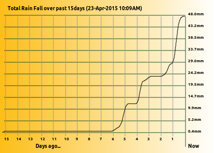
2015: Just a quick update. I read the depth Rule
this afternoon and it is now at 74cm. So the rains of the
preceding evening, plus the run off of the previous few
days trickling down (rushing down at Boggy Creek?) has
added about 24cm for about 26mm of rain beginning 3 days
ago. The overall total rainfall, of this recent downpour,
is about 60mm, so about another 12mm added to the graph
shown below. |
| 23 April 2015:
The official level from the rule at Nos2 Boat Ramp
is 50cm (+ -10mm) this is after 50mm of rain in
the last week. The sand banks inside the lake, out
in front of the Tavern car park, are just about
covered, with only the bigger ones just at the
water surface. So about 15cm since last reading. The 20mm rise in the last 24 hours is fairly smooth and the result of the East Coast Low that smashed up part of the Hunter and Illawara coast trickling down to us as pretty continuous, but not stormy weather. Fortunately we had a pretty strong high pressure zone come in from the GAB and it pushed most of it away. |
 |
| 19 March 2015: The official level at the moment is at 0. 35m at the moment and likely to stay that way at a low level for Easter holidays. However boat launching seems to be going well and no holds ups or boats grounding on the way in or out. |
| 5 February 2015: Sand Bar has well and truly closed over and we are heading towards the lake's minimum levels at the moment. If there is low rainfall and high evaporation then we will see the lake drop a little lower. Leaching from the ocean through the recent sandbar and into the lake will make sure it does not go too low, but it will most likely be at a low level for Easter holidays. |
| 20 December 2014: Algae still a problem, but plenty of tidal movement in and out of the opening so it is difficult to give an exact height. But on our new measuring board it was saying 30cm on an outgoing tide. So still quite low, but plenty of flushing going on. The recent rains about 100mm over the last two months has kept the opening clear, but also washed a lot of dark tannin water into the upper systems that is also being flushed out as well. Anglers are saying the colour is helping catches. Not so easy to spook the fish. |
| 23
November 2014:
Not much to report. The lake is still tidal and
the opening is moving about a bit and laying
down different little channels behind the main
bar. Quite a few people seem to enjoy trying
their luck fishing in the short channel that is
the opening. Sorry no news on their success or
otherwise (haha, would they be honest if I asked
them?). There should be a few comfortable little
holes behind the main bar by the time summer
gets here (by today's temperature it is going to
be pretty soon) for a quiet swim with the
littlies. There are fairly big mats of green algae (not the blue green nasty stuff) growing quickly in the shallow waters behind the bar, and around the mud islands. Today a southerly lifted a whole lot off and it quickly travelled across the lower lake area in a northerly direction across to the Tyers Aboriginal Trust. This is a seasonal thing and will be over in a few weeks, but can be a bit daunting if you get a pile of it on your line. |
 |
13 September 2014:
The lake is open and freely tidal, with the
southern part of the lake showing distinct tidal
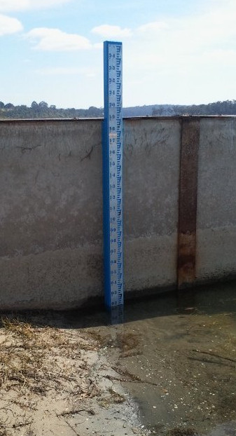
rush of waters. The big news is though, someone has installed an official depth measurement rule on the concrete wall at Boat Ramp Number 2. This will now become our gold plated standard for reporting on. If you don't usually launch you boat there and see the rule, you might like to visit it so you know what we are talking about. Here is a picture of what it looks like, though the significance is lost if you can't see it in the wider context. What it does mean is that between very low level as it now (0.1m) the water has to rise about to 2.1m to break out. |
20
July 2014: Lake has been opened by a
man with a spade and produced a broad shallow
entrance. This will be deepened and narrowed
by tidal action over the next weeks, until the
SW to NE currents carrying sand along the
90mile beach begin to slowly close it over
again.
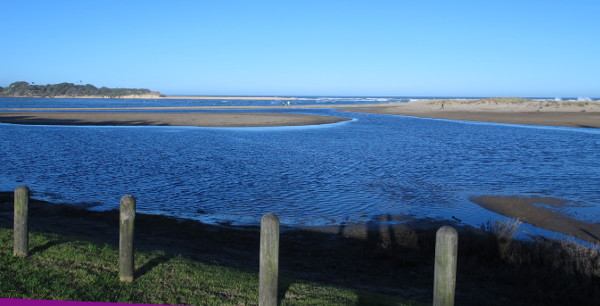
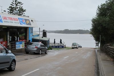
View from Waterwheel Beach Tavern car park
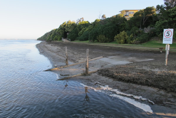
The old boat ramp near Number 2 Boat Ramp Lake Tyers Beach.
The vegetation will take a while to grow back as the lake was quite high, nearly full, for a couple of months.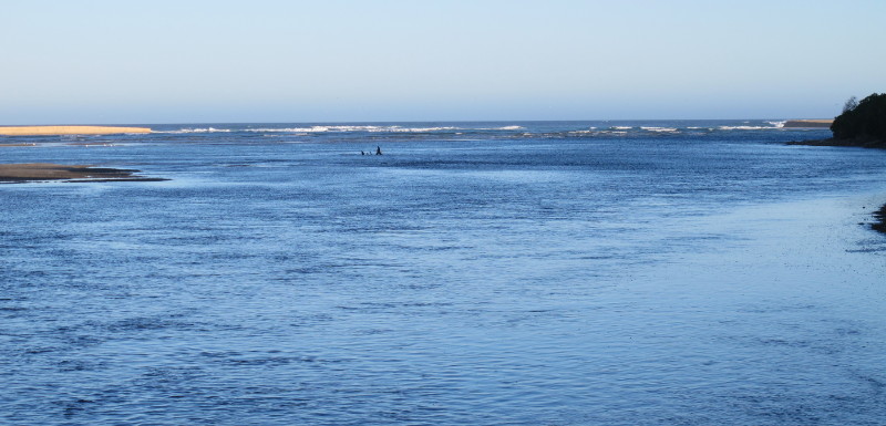
18July
2014: Heavy
winds and seas pounding the sand bar. However
it will probably need 30-40mm to push it out.
Lake needs to rise about half a metre to do
it. Probably only a matter a few weeks and
that will turn up. However in the interim,
plenty of water and fish for the persistent.
30 June 2014: Some more rain has fallen, about 10mm max this time. Just enough to keep the ground wet and any further rain likely to be mainly run off, and into the lake. The lake is not far off breaking out. Maybe another 20-30mm (lake level) might do it. One more good East-Coast Low and it will be out!
View from Waterwheel Beach Tavern car park
The old boat ramp near Number 2 Boat Ramp Lake Tyers Beach.
The vegetation will take a while to grow back as the lake was quite high, nearly full, for a couple of months.

30 June 2014: Some more rain has fallen, about 10mm max this time. Just enough to keep the ground wet and any further rain likely to be mainly run off, and into the lake. The lake is not far off breaking out. Maybe another 20-30mm (lake level) might do it. One more good East-Coast Low and it will be out!
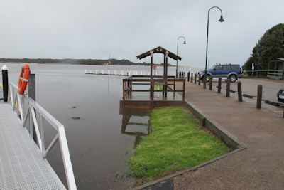
As
you
see the wooden jetty is under water
(background) and the ramps (which work so much
better) onto the floating jetties are pointing
slightly up. The
concrete wall (lower left) is just poking
above the water, and the effects of the wild
windy weather on weed is shown at the
bottom. The floor of the cleaning table is
only about 100mm above the water
12 June 2014:
We have had about 40mm since the last report and
this has topped up the lake somewhat with major
parts of the Mud Islands being covered and
making for easy boat navigation. Fishing
activity has slowed somewhat with only a few
boats taking advantage of the mild weather and
clear, calm days.
3
May 2014:
There has been a slight drop in the lake, but
still and ideal height for boating, and if
one's luck or skill is good enough for fishing
as well. Main ramps have been easy to use and
not crowded.
 14
April 2014: Well
I
measured it at 80mm over the weekend and I was
amazed at how the lake had lifted. Opinions
were varied at the local watering hole, ie the
Tavern, some saying 5 feet!! others saying a
half a metre. On the conservative side I would
tend to say 500mm approx, but this is still a
very significant amount. All the sand bars
that were in front of the Tavern over Jan/Feb
have been covered. Apparently there is more to
come down, as the Nowa Nowa Mountain auto'
rain recording had120mm and Boggy Creek is
still pushing plenty of water down. What this
means to the Easter fishing remains to be
seen. The ground is soggy, so any more in the
next week or so will lift the level even
further. Stay tuned.
 20
March 2014:
With Easter around the corner a report on the
level of the lake will not be out of order, and
I am sorry to report that it is at one of its
lowest times for this summer. We have had about
17mm of rain this last fortnight but it hardly
made a difference, though I am sure the plants
on the banks of the lake would have appreciated
it. So a lot of the sand flats around the Mud
Islands are exposed and water directly behind
the sandbar is divided into smaller channels.
The water quality is good with only isolated
reports of annoying weed. However lower water
usually means hotter water and less for the fish
to hide in :-) plus boating people beware, less
for boats!!
20
March 2014:
With Easter around the corner a report on the
level of the lake will not be out of order, and
I am sorry to report that it is at one of its
lowest times for this summer. We have had about
17mm of rain this last fortnight but it hardly
made a difference, though I am sure the plants
on the banks of the lake would have appreciated
it. So a lot of the sand flats around the Mud
Islands are exposed and water directly behind
the sandbar is divided into smaller channels.
The water quality is good with only isolated
reports of annoying weed. However lower water
usually means hotter water and less for the fish
to hide in :-) plus boating people beware, less
for boats!!18 January 2014: We
have probably seen the best of the lake depth
for a while unless there is a cool change and we
get some decent rains. Evaporation is revealing
a few sand bars that were hidden by a few 10's
of centimetres a month ago, are now peaking
through the water. The large area of shallows
around the islands will become gradually not
navigable even for canoes with the shallowest of
drafts. There is still plenty of good water
around though and the half glass full people
will tell you there is less water for the fish
to hide in :-) Just keep an eye out when
underway at high speed that a path you zoomed
over effortlessly may be a lot shallower than it
was 1 month ago.
14 December 2013:The
sandbar is pretty well established and the lake
is relatively high, though it will decrease
slowly over summer with evaporation and leakage
back under the sand bar. However rain could
easily top it up. We have had good rains this
year generally speaking and no reason why could
could get more. The fish may begin to stabilize
a bit more with this closed over and the water
temperature allowed to rise.
26 November 2013: The
lake has continued to stay open, some heavy
rains and associated storms has kept the bar
open and gradually moving across to the eastern
side of the bar. West to East currents gradually
build san up on the West side and any strong
outflow from the tides and rains tend to eat
away at the east side. The water in lake though
seems extremely healthy with plenty of good weed
(ie not Blue Green). However with the opening
nearly closed it is at a low level, and when it
does close it will get even lower. The tides
keep it higher, but when it closes and the tides
are not at least putting some in during high
tide, it seeps out through the bar and levels
out at the mean tide level, often a good 30-40cm
below where it is now. The lake will not rise
until either enough debris blocks the porous
sand on the bar (eg algae and slime) or there is
enough rain to tip the balance in favour of more
water flowing into the lake from Boggy Creek
than what is escaping through the sandbar. I
suspect we will have a low lake over summer.
30th June 2013: The
channel through the sandbar has narrowed and
deepened with strong tidal flows occuring. The
channel back into the lake is mainly down the
between the islands and may not be very
conducive to keeping the boating channels open
past the Nos2 Boat Ramp or freshening up the
waters in front of the Tavern car park. However
the water is good and clean and definitely
giving the tannin laden water from the catchment
a good flush in the lower lake. To go from very,
very low to break out in 5 days of rain must be
some sort of depth record.
17th
June 2013: Well
what
a downpour that was, and maybe a little more
to come. The water is lapping into the Tavern
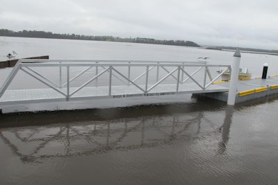
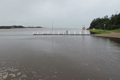
car park, covering the corner of the lowest
car park. The walkway around to the beach is
covered and the boards on the Number 2
Boat Ramp Jetty are just about covered
as well. The floating jetties however are
working well with the new ramps on the first
section. (Wayne and Gus communicating with
others). 12 hours later it broke out
through the sand bar all by itself this time.

 |
 |
 |
 |
 |
 |
15th June 2013:
Finally rain heavy enough to really lift the
lake level. The area in front of the Tavern car
park is just about completely covered with a
15-30cm of water. The big blow from the South on
Friday caused the sea to wash over into the lake
which will have also contributed to the rise as
well. the rainfall would have been in the order
of 60mm.
June 14 am with sea washing over the
sandbar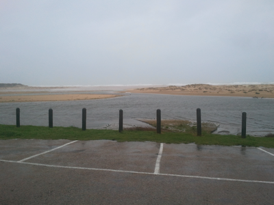 |
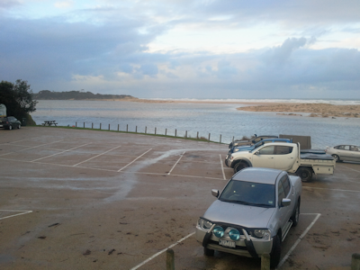 One day later June 15 pm with sand flats covered |
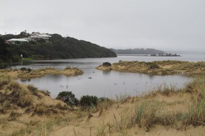
17th
January
2013: There
has been little rain and only minor high tides
flooding in so the lake has been dropping to
its minimum at this time. There are large area
of sand exposed and algae drying out on it
behind the bar. This current hot dry spell is
lovely weather for activities but it is taking
its toll on the lake level. Lighter boats are
still easy to launch and can navigate easily
where most of the fish are to found. Here is a
view from one of the tracks at the end of our
street out onto the sand behind the bar.
(Petmans Beach is behind the far dune)


